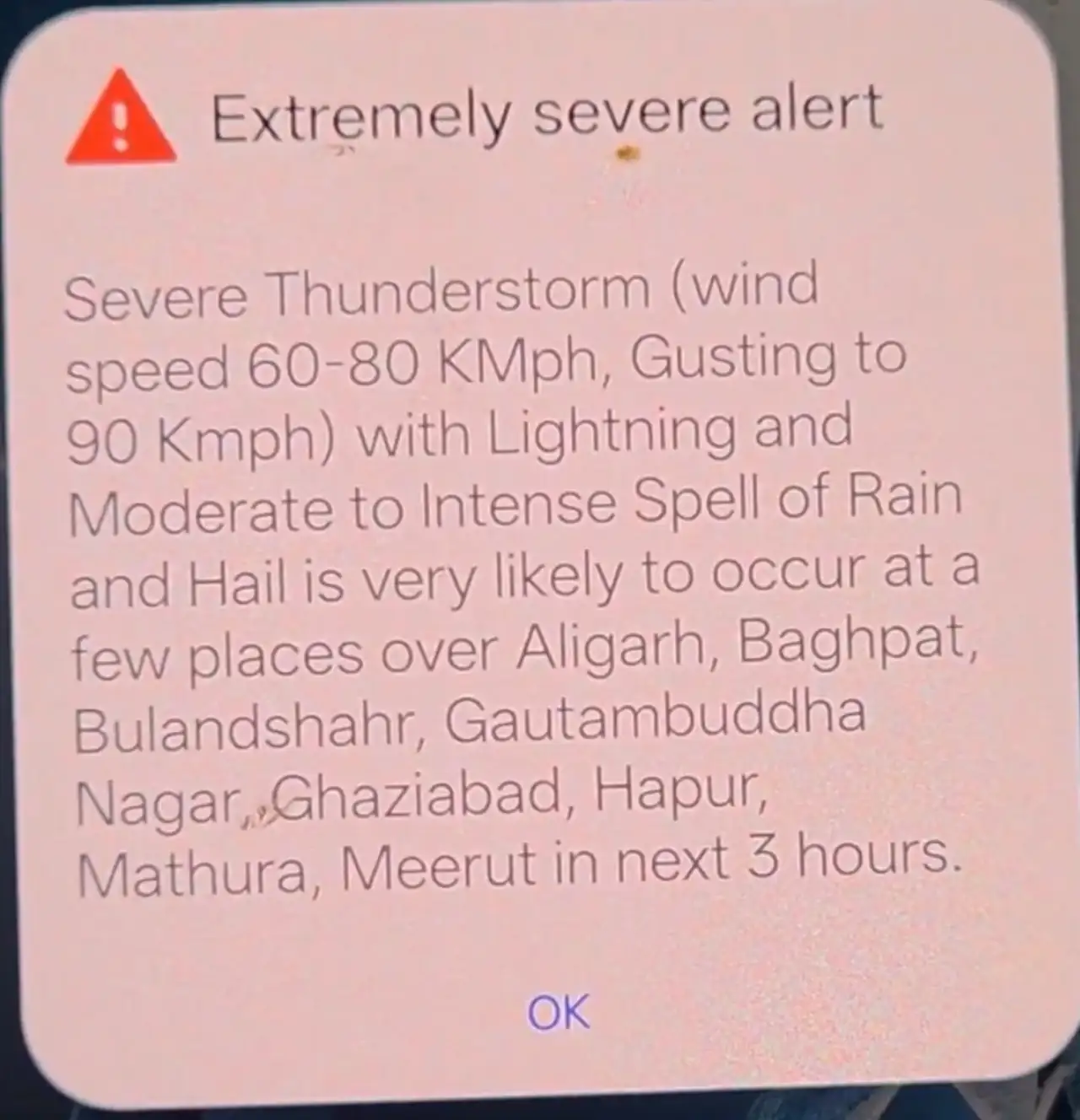
The India Meteorological Department (IMD) has issued an Extremely Severe Alert for severe thunderstorms, strong winds, lightning, heavy rain, and hail across several districts in Delhi-NCR and western Uttar Pradesh, as a powerful pre-monsoon weather system continues to sweep through North India.
This hyper-local Nowcast warning, valid for the next 2-3 hours from issuance, warns of:
▪️Severe Thunderstorm with wind speeds of 60-80 kmph, gusting up to 90 kmph
▪️Lightning
▪️Moderate to intense spells of rain
▪️Hail at a few places
The alert specifically covers: Aligarh, Baghpat, Bulandshahr, Gautam Buddha Nagar (Noida/Greater Noida), Ghaziabad, Hapur, Mathura, and Meerut.
Broader Weather Situation Across India
According to the IMD, the intense heatwave that gripped large parts of North and Central India has largely abated due to widespread thunderstorm activity. On May 30, 2026, several regions are experiencing significant cooling accompanied by rain and squalls.
Key Alerts Today:
▪️Orange/Red Nowcast Warnings for thunderstorms and gusty winds in Delhi-NCR, Haryana, Punjab, Rajasthan, and Uttar Pradesh.
▪️Isolated heavy rainfall likely over Uttarakhand, Punjab, Haryana, Chandigarh, West Uttar Pradesh, and parts of South and Northeast India.
▪️Hailstorms possible in Himachal Pradesh, Uttarakhand, Punjab, Haryana, Delhi, Rajasthan, Madhya Pradesh, and Chhattisgarh.
▪️Thundersqualls with winds reaching 60-80 kmph (gusting to 90 kmph) in isolated pockets.
Impact on Delhi-NCR
Residents of the National Capital Region are witnessing a sharp drop in temperatures, with maximums expected to hover around 34-36°C, down from recent highs near 45°C. Cloudy skies, intermittent rain, and gusty winds have brought welcome relief but also triggered concerns over:
▪️Tree falls and damage to weak structures
▪️Waterlogging in low-lying areas
▪️Traffic disruptions and reduced visibility- Power outages due to strong winds and lightning
▪️Similar conditions are expected to persist through May 31 before the system gradually moves eastward.
Safety Precautions
The IMD has urged people in affected areas to:
▪️Remain indoors during peak thunderstorm activity.
▪️Avoid open fields, rooftops, and taking shelter under trees.
▪️Unplug electrical appliances and avoid using mobile phones during lightning.
▪️Secure loose objects outdoors.
▪️Drivers should reduce speed and exercise caution on highways.
▪️Farmers in the region are advised to protect standing crops from hail and strong winds.
The Southwest Monsoon continues its northward progression, with favorable conditions for further advancement into more parts of the country in the coming days. While this pre-monsoon activity is providing relief from the heat, it also signals the transition into the rainy season.
For real-time updates, citizens are advised to monitor the official IMD website (mausam.imd.gov.in) or the district-wise Nowcast section for the latest alerts.
Stay safe and prepared as this volatile weather pattern continues across North India.